Tokushima Prefecture is in the eastern part of Shikoku.
It faces the Kii Channel and shares a border with all of the Shikoku Prefectures: Kagawa, Ehime, and Kochi.
The geographical area of Tokushima is 4,145 km².
It has a rough population of 742,113 people.
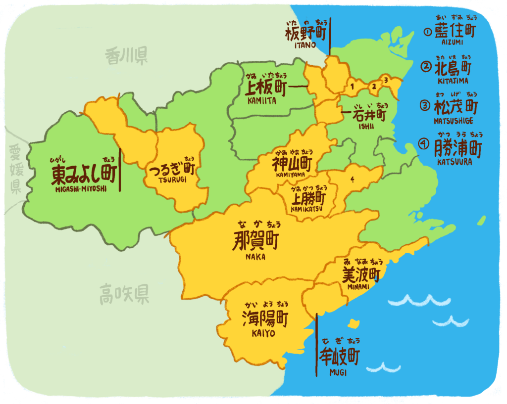
Tokushima is made up of 24 cities, towns, and villages. There were quite a few mergers during the Heisei era due to population decrease, so occasionally when visiting certain towns or cities you may see old signage reminiscent of the towns and villages it was once split up into.

There are eight cities in Tokushima ranging from 24,000 to 256,000 people in population. Most of these cities are along the north and east border of Tokushima. These cities include:

There are 15 towns in Tokushima ranging from 1,000 to 35,000 people in population. Most of these towns make up the southern part of Tokushima, with a few sandwiched between the bigger cities. These towns include:

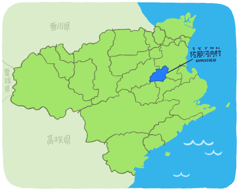
There is one classified village in Tokushima. This village is Sanagochi and it has a population of 1,983 people as of 2022. It’s famous for the peach strawberries grown there!
Like much of Japan, Shikoku is known for its humid subtropical climate, meaning hot summers and cold winters. Precipitation can be high depending on the year. Below is a chart for Tokushima City average climate data spanning from 1991-2020 from the Japan Meteorological Agency. Generally, much of Tokushima Prefecture sees a similar weather pattern, plus or minus a few degrees, inches of rain, etc.
| Month | Jan | Feb | Mar | Apr | May | Jun | Jul | Aug | Sept | Oct | Nov | Dec | Year |
| Mean Daily Max ( C ) | 10 | 10.8 | 14.3 | 19.6 | 24 | 26.8 | 30.6 | 32.3 | 28.5 | 23.1 | 17.7 | 12.5 | 20.9 |
| Mean Daily Minimum ( C ) | 2.9 | 3.1 | 5.8 | 10.6 | 15.6 | 19.8 | 23.9 | 24.9 | 21.6 | 15.9 | 10.1 | 5.2 | 13.3 |
| Average Precipitation (mm) | 41.9 | 53 | 87.8 | 104.3 | 146.6 | 192.6 | 177 | 193 | 271.2 | 199.5 | 89.2 | 63.9 | 1,619.9 |
| Average Relative Humidity (%) | 61 | 61 | 61 | 62 | 67 | 75 | 77 | 73 | 72 | 69 | 66 | 63 | 67 |
| Mean Monthly Sunshine Hours | 160.3 | 152.5 | 179.8 | 197.9 | 205.7 | 151.9 | 192 | 230.6 | 162 | 163.6 | 150.4 | 160.1 | 2,106.8 |
You will see the highest temperatures from July to September, reaching into the 30s on average. Rainfall can be the highest during the June rainy season and late August-September typhoon season. Humidity is generally high even in the winter months.
Typically, the hottest months in Tokushima will be from June to September. It’s important to exercise caution and prepare adequate means of relief from the heat during the summer. It does tend to snow in January and February in the western region of Tokushima, most notably in Iya, Miyoshi, and Mima, so it may be important to take precautions for snow if you are in these areas.
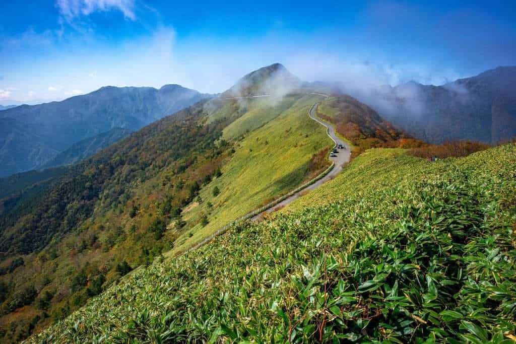
80% of Tokushima’s total land area is mountainous. Some of the most famous mountains in Tokushima are Mt. Tsurugi (Shikoku Mountains) and Mt. Bizan.
剣山 Tsurugi-san
Tsurugi-san (Sword Mountain) is a 1,954 meter high mountain in the Shikoku Mountains chain bordering Miyoshi, Mima, and Naka. Tsurugi is the second highest mountain on Shikoku and has a national park surrounding the mountain called Tsurugi Quasi-National Park. Atop Tsurugi sits Tsurugi Shrine. There are many hiking trails on this mountain and a chairlift that can take you halfway up the mountain.
眉山 Bizan
Bizan (Eyebrow Mountain) is a small mountain only 280 meters high in the middle of Tokushima City. It’s said to resemble the contours of an eyebrow from all directions, hence the name Eyebrow Mountain. On a clear day, you are able to see Awajishima and across the Kii Channel to Wakayama Prefecture from the top. There is a ropeway up to the summit and also several climbing routes.
讃岐山脈 Sanuki Mountains
Another mountain range along the border of Kagawa and Tokushima. Its highest peak is Ryuozan (1,059 meters) and is also included in Otaki-Okawa Prefectural Natural Park.
Tokushima has access to many bodies of water. One of the most notable is the Yoshino River, a centrally located river which passes through all of Tokushima before veering south to create the Oboke and Koboke Gorge in Iya. It is the second longest river in Shikoku and crosses through all four prefectures.
The southern coast of Tokushima, namely near Kaiyo, Mugi, and Minami towns, is known nationwide as a great surf spot. Many people travel to this area for the beautiful beaches and great waves. You can get surf lessons and board rentals from various shops around the area during the warmer months.
Tokushima also borders the Seto Naikai, or Seto Inner Sea. This is the sea separating Shikoku from Honshu. Every three years, the Seto Triennale, an art festival spanning various islands within the Seto Naikai, is hosted in neighboring Kagawa Prefecture. If you have a chance to visit in the summer or fall, go check it out!
Since April 2012, nine percent of the total land area in Tokushima has been designated as national parks. Setonaikai National Park is actually the largest national park in Japan! Many of these parks are also home to temples that are a part of the Shikoku Henro. The pin maps below aren’t always the exact location since many aren’t recorded on Google Maps, but the coordinates used for those parks are shown or a nearby location.
Tokushima is a wonderful place to live, renowned across the country for its beautiful natural scenery. You can see some examples of gorgeous places across Tokushima thanks to our friends at Hidden Tokushima, or explore all of Shikoku with Shikoku Tourism!

All rights reserved ©Tokushima AJET | Web Design By Gabrielle Vasquez | Art by Katya